A trip through Puna.
Puna
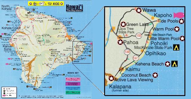
is a district on the Big Island of Hawaii located in the southeast part of the island. Being on the windward side of the island it receives quite a bit more rain that some of the other districts of the island. As a result there is an explosion of vegetation year round. Most of Puna is thick lush jungle and the first time you enter it you get a very eerie feeling and you have to keep reminding yourself that you are still in the United States.
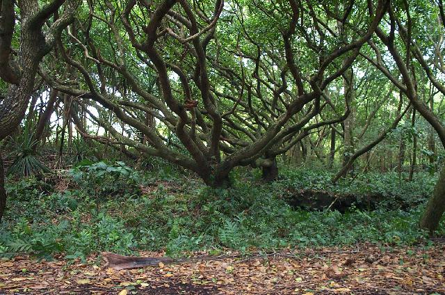
The wife and I have driven through Puna many times. Our first trip started by going to the end of the road that used to loop around to the Chain Of Craters Road in the Volcanoes National Park. The 1983 to present lava flow of Kilauea
volcano has consumed the road at a village called Kalapana
. Right at the end of the seaside road is a Hawaiian home that was spared the wrath of the lava by a mere few feet! The remainder of the village was destroyed with only a few homes left in the few places where the lava parted. Only residences were allowed past the end of the highway.
|
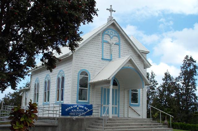
Picture taken 2001
Star of the Sea Painted Church
Just prior to the road that goes off to the left toward the sea at Kalapana resides the Star of the Sea Painted Church. There are two of these Painted Churches on the Big Island and each has a very interesting history. The other, located all the way across the island, is St. Benedict's in Honaunau
near the Kealakekua
Bay of the song "Little Grass Shack" fame. It also was the church of Father Damian who later went to the famous leper colony on the island of Moloka'i
.
Painted churches came into being because the early priests used paintings on the walls as props for their sermons. Since the Hawaiians had no written language, the pictures formed a record of the major events in Jesus' life and teachings.
What makes the Star of the Sea Painted Church unique is it used to sit on a site that was consumed by the lava flow. The people of Puna moved the church some half mile inland to the site where it is now on the Kalapana-Pahoa
highway. It is no longer a sanctioned Catholic church and the ownership has been turned over to the local historical society, the Kalapana Ohana
Association. Having seen both Painted Churches, I must say this one is far and away the prettier of the two.
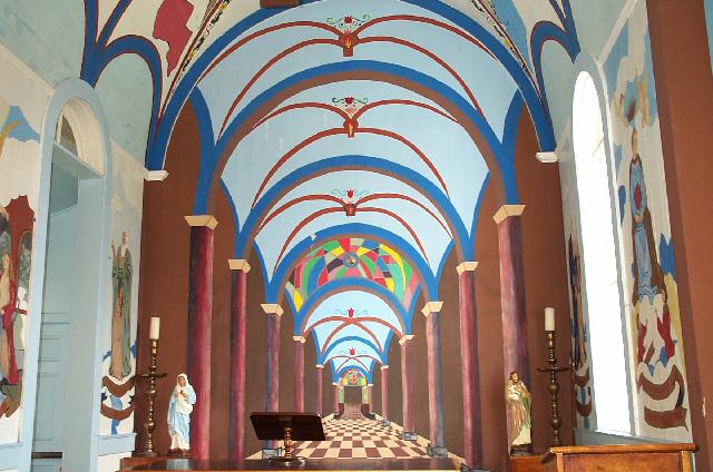
PAINTED CHURCH CEILING
If you have a chance to visit this gem, I would highly recommend a stop. And be sure to bring your camera.
Since that earlier picture was taken, the church has received a new paint job on the outside and looks quite different in 2006.

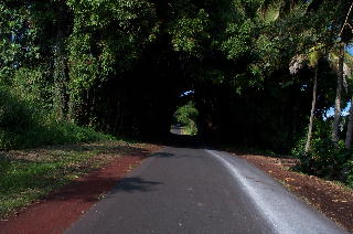
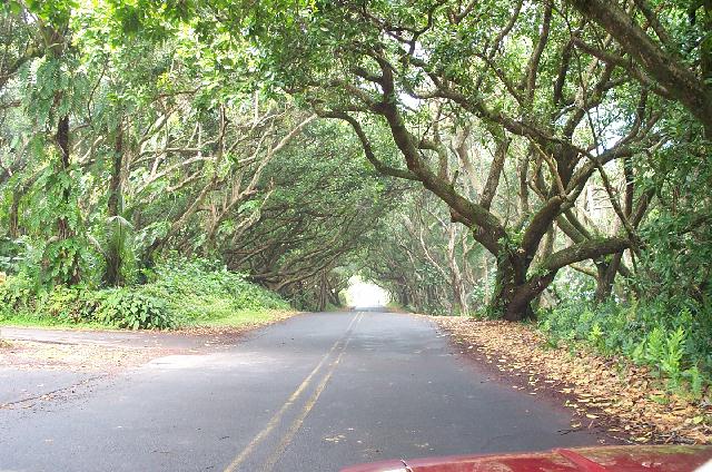
Now as we travel northeast on highway 137 we enter a dense lush jungle. Depending on the particular year the road varied from excellent to poor with poor being quite bumpy. Combine a poor road with a coverage from the trees that almost blocks out the sun, and you have eerie. At this point I would recommend a fairly slow pace which is fine as you will want to drink in the beauty of this part of the island. The road is not far from the sea, but you would not know it except for a few breathless breaks where the road runs right beside the ocean.
Not too far from Kalapana you will come to Kehena
Beach, a black sand beach. We've never been to the beach due to its reputation of being a clothing optional beach, but I understand it is a beautiful and secluded beach. A little ways further you will come to MacKenzie State Park. This park is a favorite pit stop for us and it would be an excellent place for a picnic. The restroom facilities here are more like outhouses, but it always seems to be pretty decent otherwise. There are many ironwood trees at the park which provides complete cover from the sun. Everywhere on the ground is the needles from the trees. The trees keep any ground cover from growing so when it is raining it can get quite muddy. But then who picnics in the rain?
|
|
|
|
Just a little further the road joins
highway 132 and with a turn to the right you will find the Pohoiki |
Just a little further down the road you will come to a unique place called Pu’ala’a
. This is a spring and ocean fed pool that has a man-made wall making a barrier to the ocean. Puna in Hawaiian means spring and this is one of many springs in the Puna District although this one is a little different. The water comes out hot! The pool is heated by the spring to a very warm 90 degrees or so. There is usually a lifeguard at the site, so it is a very safe place to swim. This will be a swim you will remember the rest of your life. Well worth stopping.
Continuing on the road toward the northeast, which is only relevant if you have a compass or are following a map, you come to route 132. Turning to the left you will go to the town of Pahoa and turning to the right you will go to the Cape KumukahiLighthouse.
At this point it is really a beacon, but is very important to the fishermen in the area as it marks the east most point on the island. According to local lore during one of the recent lava flows in this area, the lava threatened the beacon. A Kahuna
came down to the beacon and made some sacrifices to Pele
, the Hawaiian Volcano Goddess, and did some chanting and caused the lava to change course sparing the beacon. Now when you see the beacon, you realize it looks like that actually happened. The lava flow stops right at the slab for the beacon and continues to the sea on the far side. A word of warning: the road down to the beacon is dirt and can be very washboardy so bear this in mind. A picture of the beacon with the lava wrapped around it makes a great backup for repeating the story.
|
|
